




by Redazione 18/10/2026



Categories: Ancient art / Disclaimer
After more than a year of work, the planisphere and the five maps depicting the continents and the provinces of Belgium are once again on display at Palazzo Spinola (Genoa). These artifacts, created in the Netherlands in the 17th century, document the geographical knowledge of the time and a rich imagery filled with allegories, figures, and exotic animals.
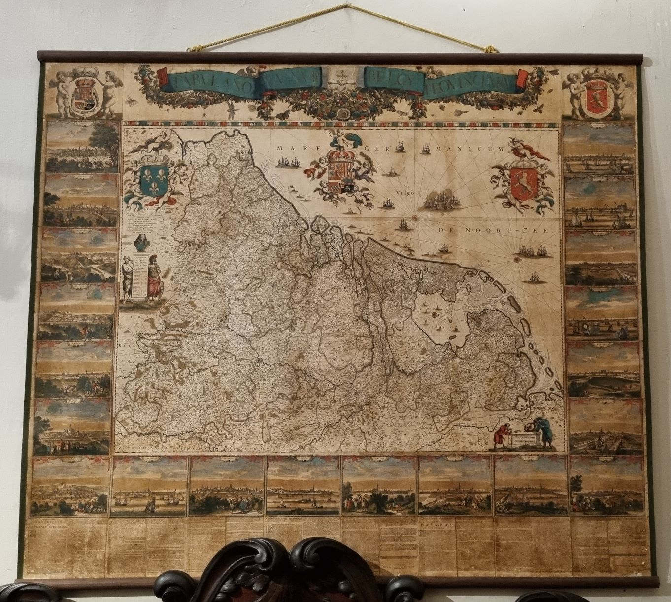
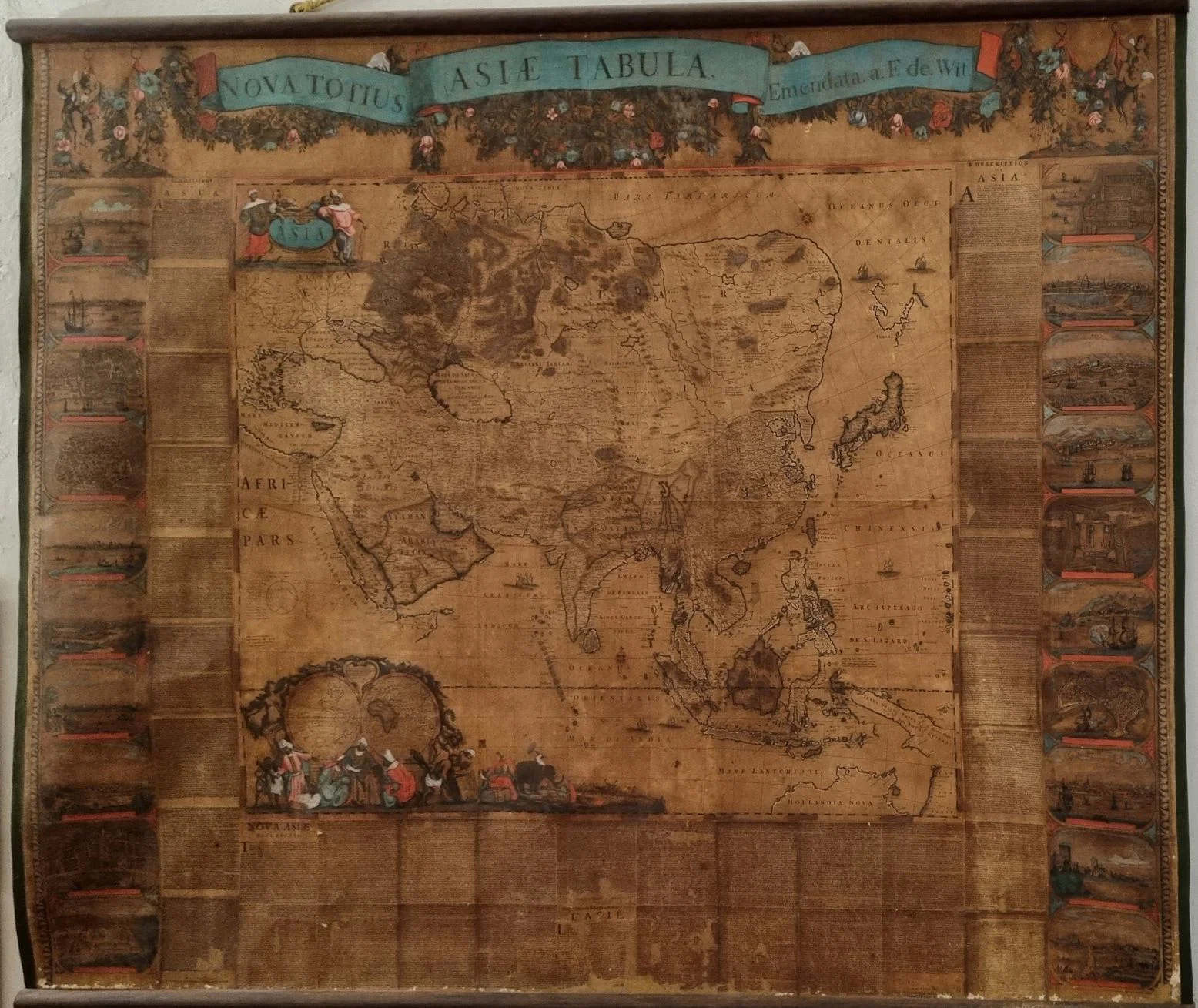
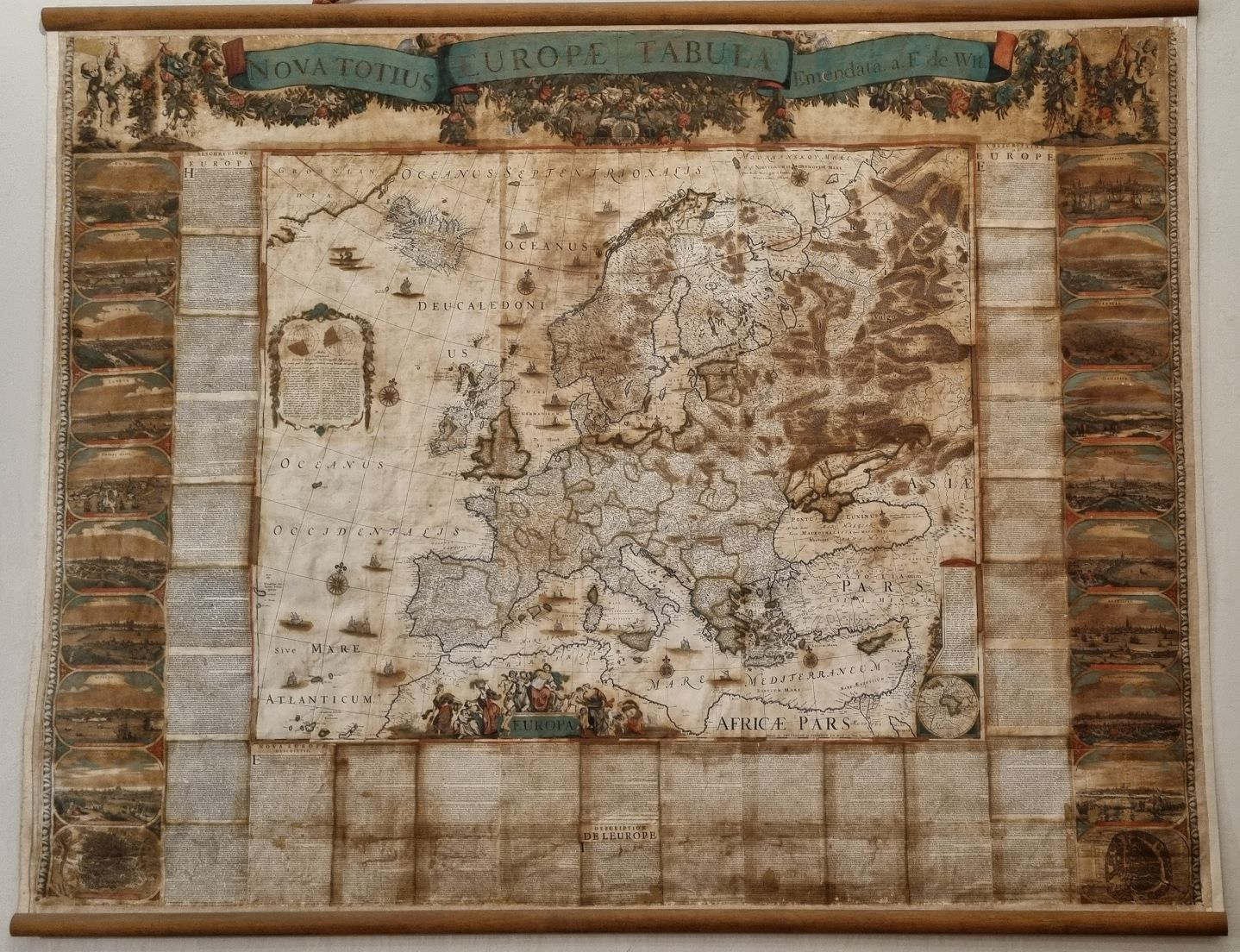
A world map and five large geographical maps created in the Netherlands in the 17th century are once again on display at Palazzo Spinola in Genoa, following a restoration project that lasted over a year. The works, part of a collection of exceptional historical and artistic interest, document the geographical knowledge of the second half of the 17th century and, through maps, inscriptions, and allegorical depictions, illustrate how Europeans of that era represented the known world. The restoration made it possible to recover inscriptions, images, and colors that had faded over time, improving the conservation condition of these particularly fragile artifacts.
The project was presented on October 13, 2026, at the National Gallery of Palazzo Spinola, as part of the seminar “The Maps of Palazzo Spinola.” The event is part of the series of public events titled “Strength in Unity: Art Bonus and Modern Patronage, ” promoted by the National Gallery of Palazzo Spinola to highlight five major restoration projects made possible by public-private partnerships.
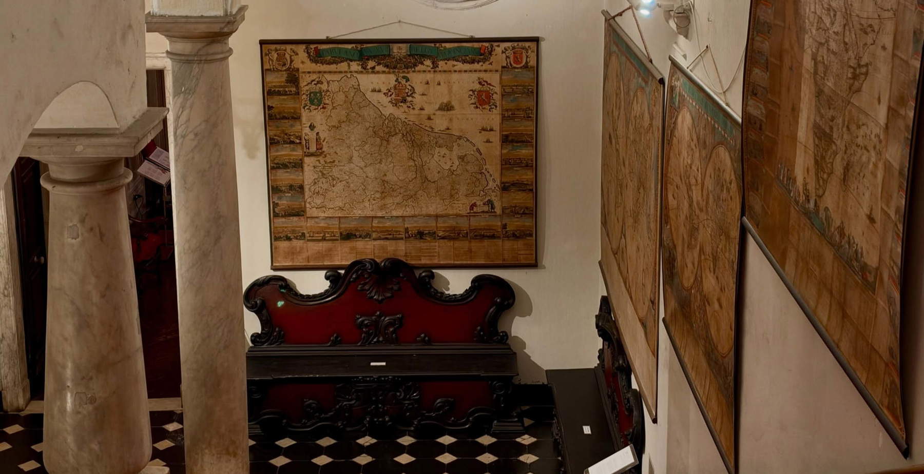
The six restored works belong to a collection of fourteen large-format maps, displayed on a rotating basis along the palace’s monumental staircase. The collection, donated by the Marquises Spinola in 1958, is unique in Italy for its rarity and the quality of its craftsmanship. The maps, created in the 17th century, are valuable examples of Dutch cartography from that period, but their significance extends beyond the depiction of territories: the textual and figurative elements, together with ethnographic details, convey a worldview in which geographical knowledge intertwines with imagination and with the still-partial understanding of the various regions of the planet.


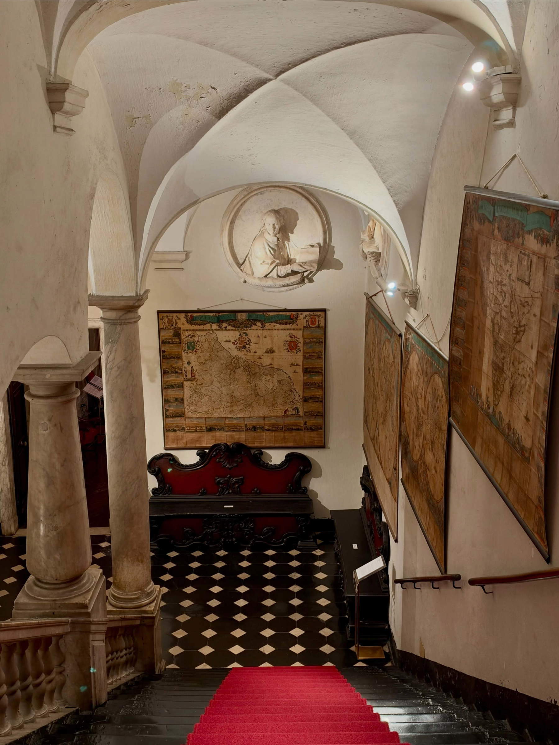
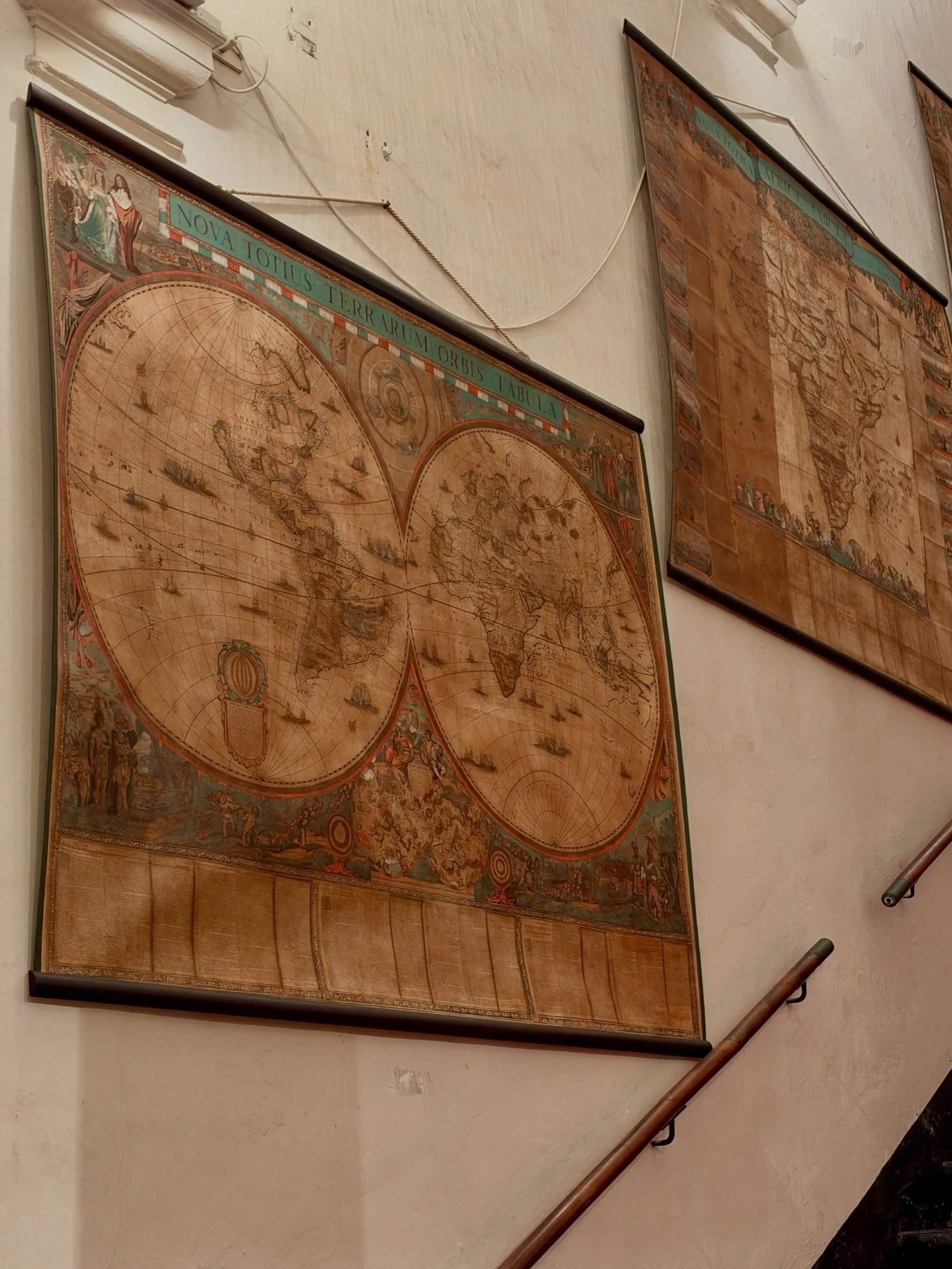
This latest restoration effort is part of a broader conservation campaign for the collection. Previously, a large planisphere and seven smaller maps had already been restored. The phase that has just been completed focused on the other six items, beginning with the *A New Map of the Entire World*, a planisphere created in Amsterdam around 1660–1663, and continuing with the maps dedicated to the four continents known at the time and the map of the seventeen provinces of Belgium. The planisphere stands out for its refined figurative decoration at the four corners, where allegories of the continents are depicted through groups of people belonging to different ethnic groups and characterized by distinctive clothing. These figures do not serve a purely ornamental purpose: they reflect how cartography of the time combined geographical description with a cultural and symbolic representation of the world’s peoples. The map thus also becomes a document of the European mindset of the seventeenth century, with its curiosities, classifications, and still-incomplete knowledge.
Particularly detailed is the *Tabula Nova XVII: The Provinces of Belgium*, dedicated to the territories of ancient Flanders, which at the time were divided between the southern part—still under Spanish rule, corresponding to present-day Belgium—and the independent northern part, coinciding with today’s Netherlands. The map has an unusual orientation: it is rotated ninety degrees counterclockwise, with west at the top. Here, too, the figurative elements enrich the geographical representation. One detail depicts the cartographers themselves at work, using the tools of their trade—a direct reference to the practices through which knowledge of the territory was produced and disseminated.
A central part of the series consists of the four maps dedicated to the continents, in which the geographical description is combined with allegorical personifications and ethnographic imagery. The *A New Map of All Asia* depictsAsia through a group of figures wearing turbans, engaged in conversation with one another: the composition evokes the idea of Eastern wisdom linked to philosophy and the transmission of knowledge, in accordance with a vision that reflects the cultural concepts of the time. The *A New Map of All of Europe* is, among the four, the one that offers the most precise and accurate geographical representation: the continent is accompanied by the mythological figure of Europa, depicted during her abduction by Jupiter, who had taken the form of a white bull. The reference to classical mythology places geography within an established iconographic tradition, creating a dialogue between the representation of the territory and the narrative heritage of antiquity.
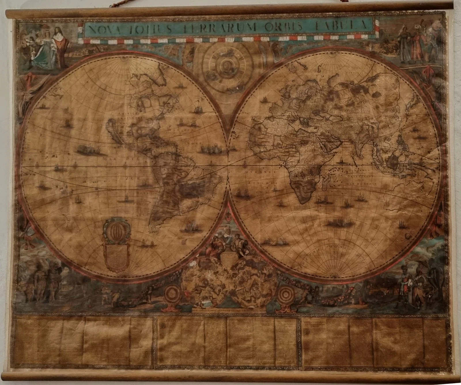
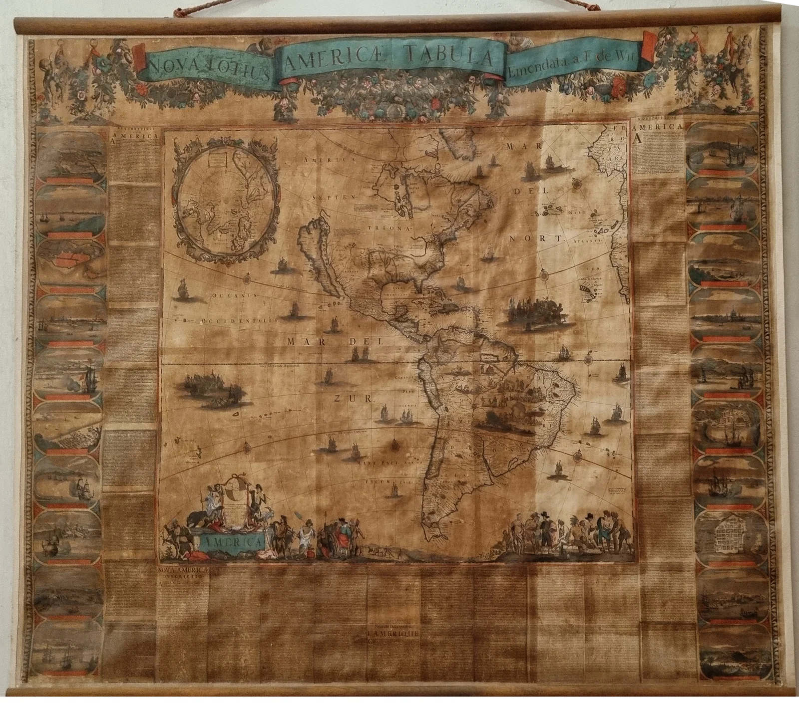
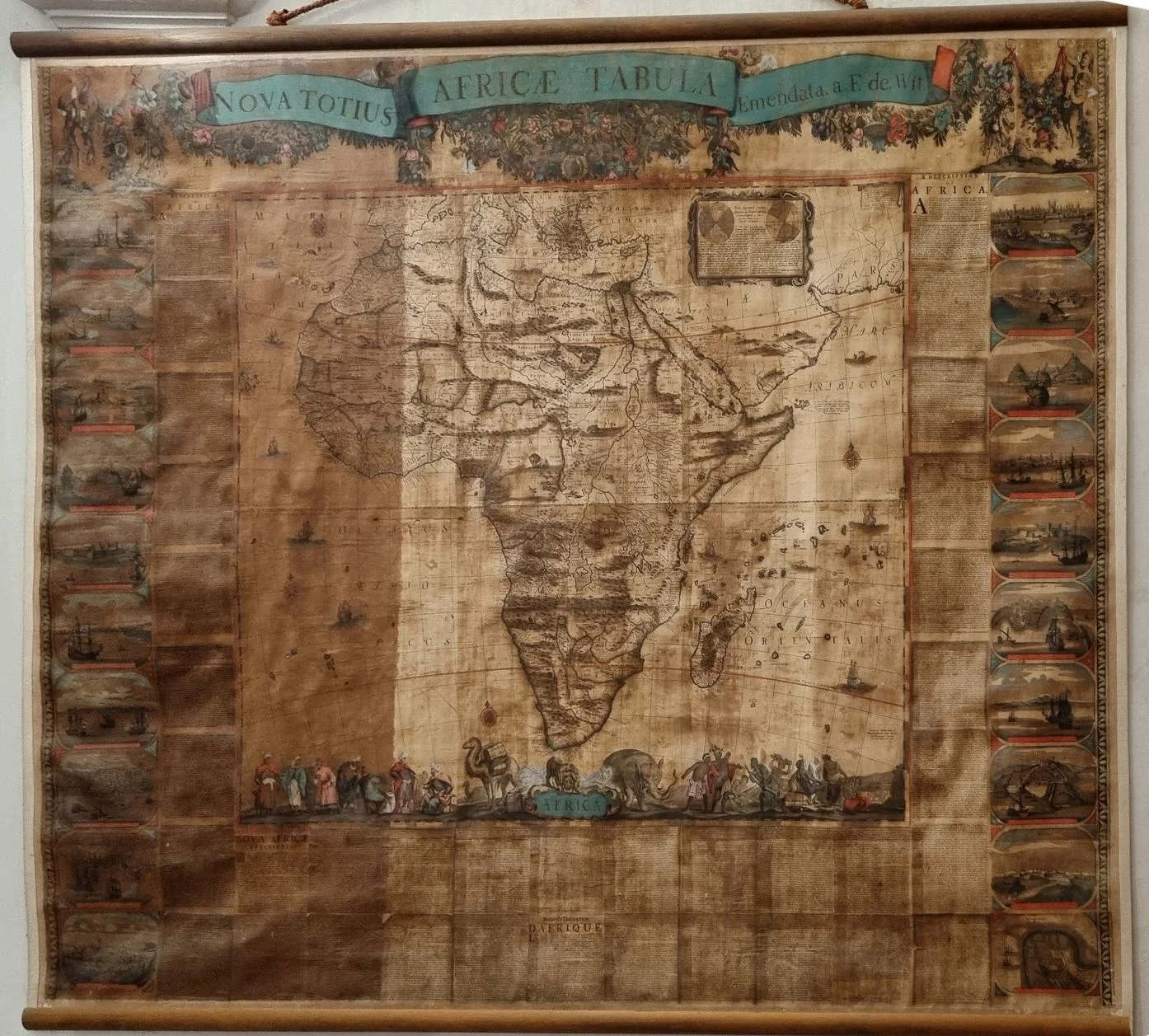
The *A New Map of the Whole of America* is particularly significant for what it reveals about the limits of 17th-century geographical knowledge.North America is depicted in a more sketchy manner, with numerous gaps and inaccuracies, while South America is shown in greater detail, especially along the coasts: the differences between the two regions illustrate how the availability of geographical information was still uneven and how maps recorded not only what had been explored but also what remained unknown or poorly documented. Finally, the *A New Map of All of Africa* presents a particularly evident intertwining of geographical observation and imagination. The figurative portion includes colorful characters and exotic animals, which make up a repertoire of the peoples and fauna associated with regions less familiar to Europeans. As with the map of America, the images here must also be interpreted within the historical context in which they were conceived: they are evidence of an interest in the non-European world that was accompanied by incomplete knowledge and representations often filtered through stereotypes and secondhand accounts.
The restoration addressed complex conservation challenges related both to the fragility of the paper substrate and to the condition of the surface, on which dirt and materials from previous interventions had accumulated. The primary objective was to restore the works’ proper flatness and remove substances that obscured the images, while respecting the nature of the materials and ensuring the future preservation of the artifacts.
The procedures included the mechanical removal of the edges and grosgrain ribbons, dry cleaning with a latex eraser, and solubility tests necessary to identify the most suitable solvents for removing the restoration varnishes present on the surface. The paper was then cleaned, and the previous backing canvas on the reverse side was removed, along with any adhesive residues and old restoration patches.
The work continued with the cleaning and deacidification of the paper, the reconstruction of the repairs, and the glazing of the works. To ensure the stability of the large sheets, a new backing structure was created, based on a tensioned polyester canvas and the use of Japanese paper. Color gaps were filled with watercolor retouching, while the final phase involved the installation of new grosgrain fabric ribbons and end rods similar in type and color to those already in place.
However, their return to the public does not mean that the maps can be displayed without restrictions: the delicate nature of the materials requires display methods compatible with conservation needs and with the display times permitted by the condition of the works.
The six maps at Palazzo Spinola offer a glimpse into an important phase in the history of European cartography, when the growing circulation of information and the broadening of geographical horizons gave rise to new representations of the planet: the precision of the coastlines, the uncertainties in less-explored areas, the allegories of the continents, and the depictions of peoples collectively illustrate the construction of geographical knowledge and the imagery through which seventeenth-century Europe interpreted the world. And thanks to the restoration, this heritage is once again visible in all its rich detail—from inscriptions to decorative images—offering the public not only documents of the history of cartography but also testimonies to the visual culture, curiosities, and cognitive limitations of an era.
 |
| Genoa: Six Large 17th-Century Maps from Palazzo Spinola Have Been Restored |
Warning: the translation into English of the original Italian article was created using automatic tools. We undertake to review all articles, but we do not guarantee the total absence of inaccuracies in the translation due to the program. You can find the original by clicking on the ITA button. If you find any mistake,please contact us.