


A major new underwater archaeological campaign in the Tiber River is helping to reshape our understanding of Rome’s submerged heritage. The joint Italian-British mission has shed new light on a vast complex of archaeological remains preserved in the historic center of the capital. The project, called the Archaeological Survey of the Tiber, is led by Rome’s Special Superintendence for Archaeology, Fine Arts, and Landscape, the Central Institute for Restoration (ICR), and Barca Archaeology in Oxford, United Kingdom, with funding from the National Geographic Society. The research findings are being presented on the occasion of the first UNESCO International Day of Underwater Cultural Heritage, established to draw attention to the importance of underwater archaeology and the need to protect this heritage in Italy and around the world.
This occasion holds special significance for Rome, which is already inscribed on the UNESCO World Heritage List and is now increasingly recognized for the importance of its underwater cultural heritage. In fact, the UNESCO site’s Management Plan identifies the riverine landscape—comprising the Tiber and the Tiber Island—as one of the site’s defining elements.
The research is led by Barbara Davidde, director of the ICR’s Underwater Archaeology Unit, and by Peter Campbell of Barca Archaeology. Alessandra Fassio is the project manager for the Special Superintendence of Rome. The activities have received support from the National Geographic Society and NORBIT Subsea, while a crucial operational contribution has come from the Rome Carabinieri Underwater Unit and the Rome Fire Department’s Diving Unit. Also collaborating on the research are underwater archaeologist Roberto Petriaggi, former director of the ICR’s Underwater Archaeology Unit and creator of the “Restaurare sott’acqua” project, marine geophysicist Aleksandra Kruss of NORBIT, and marine archaeologist Lisa Briggs of Barca Archaeology.
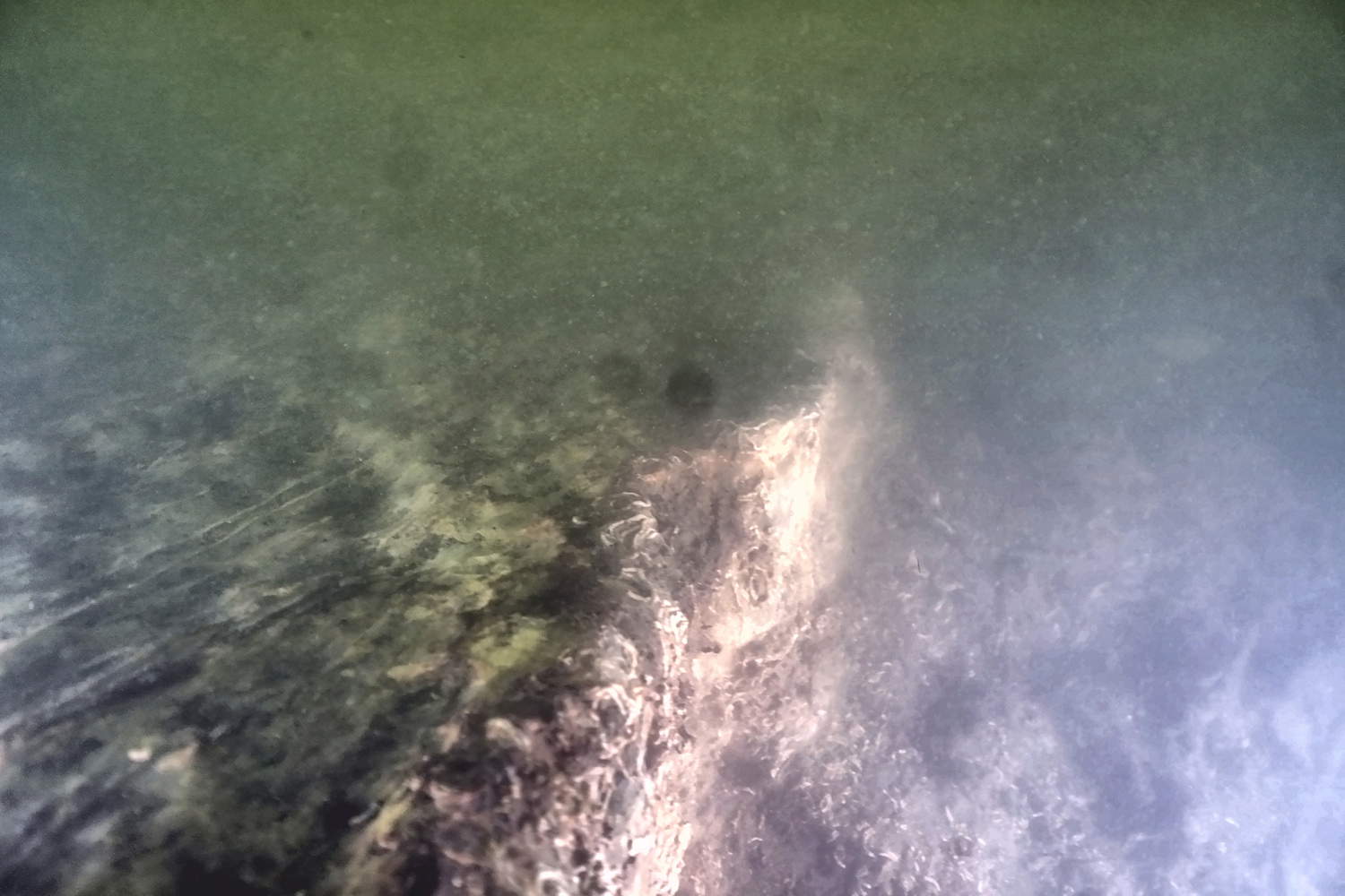
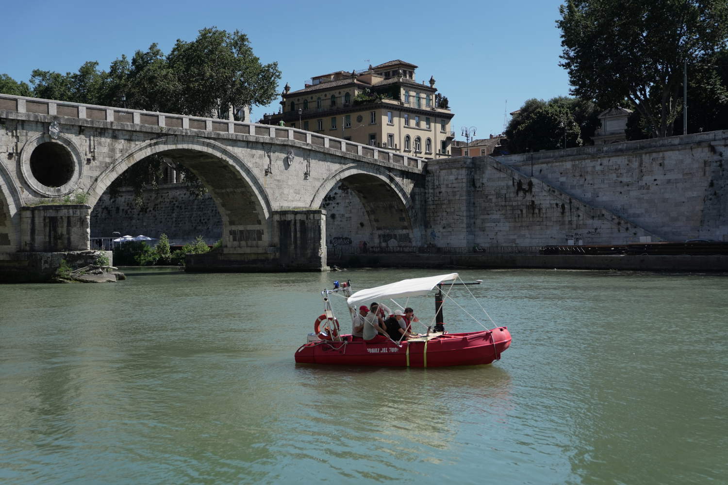
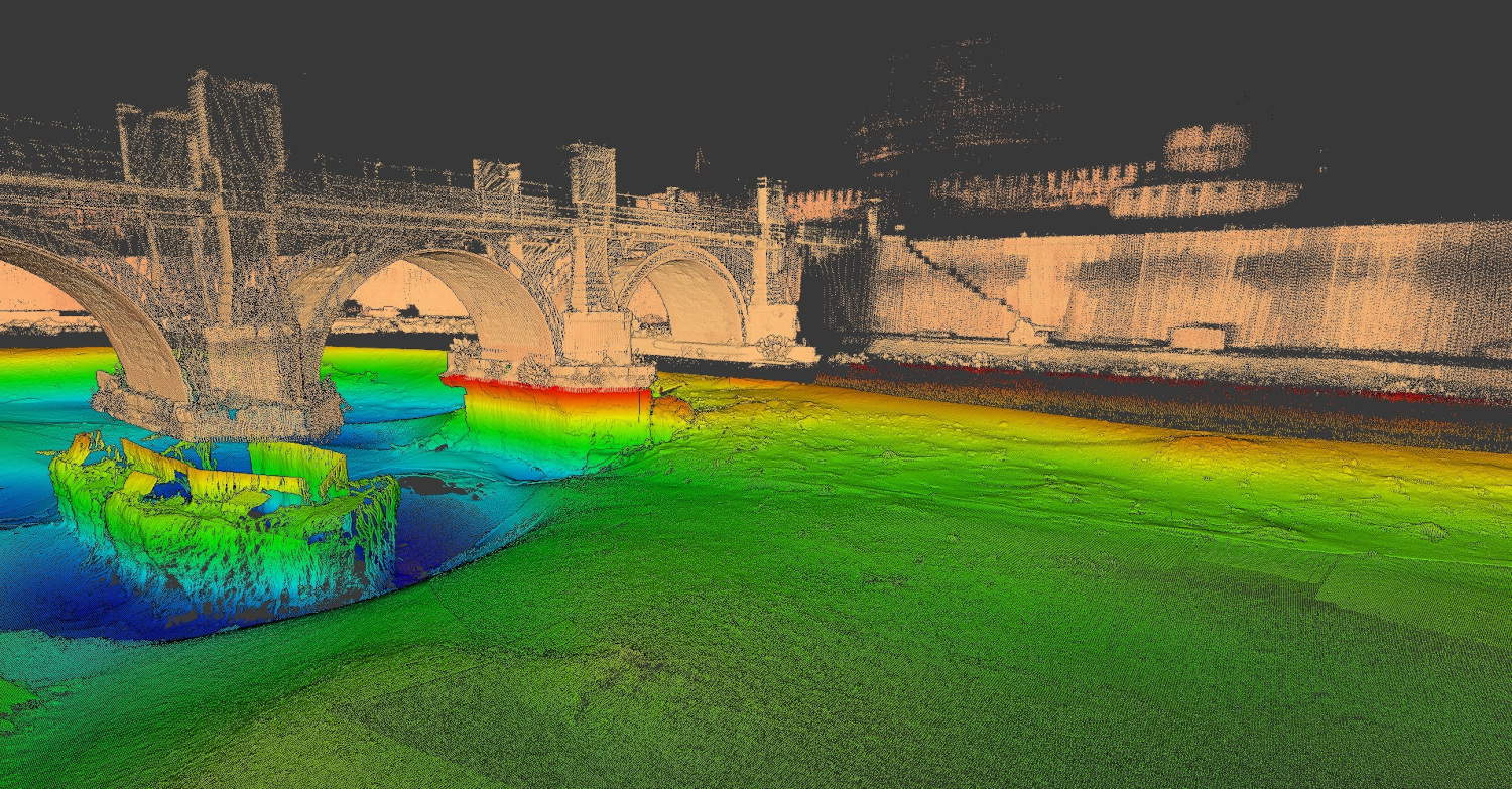
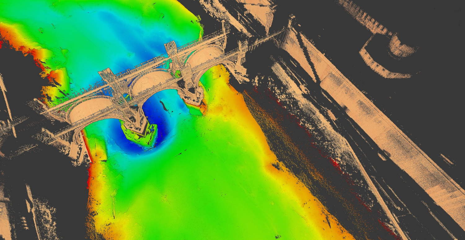
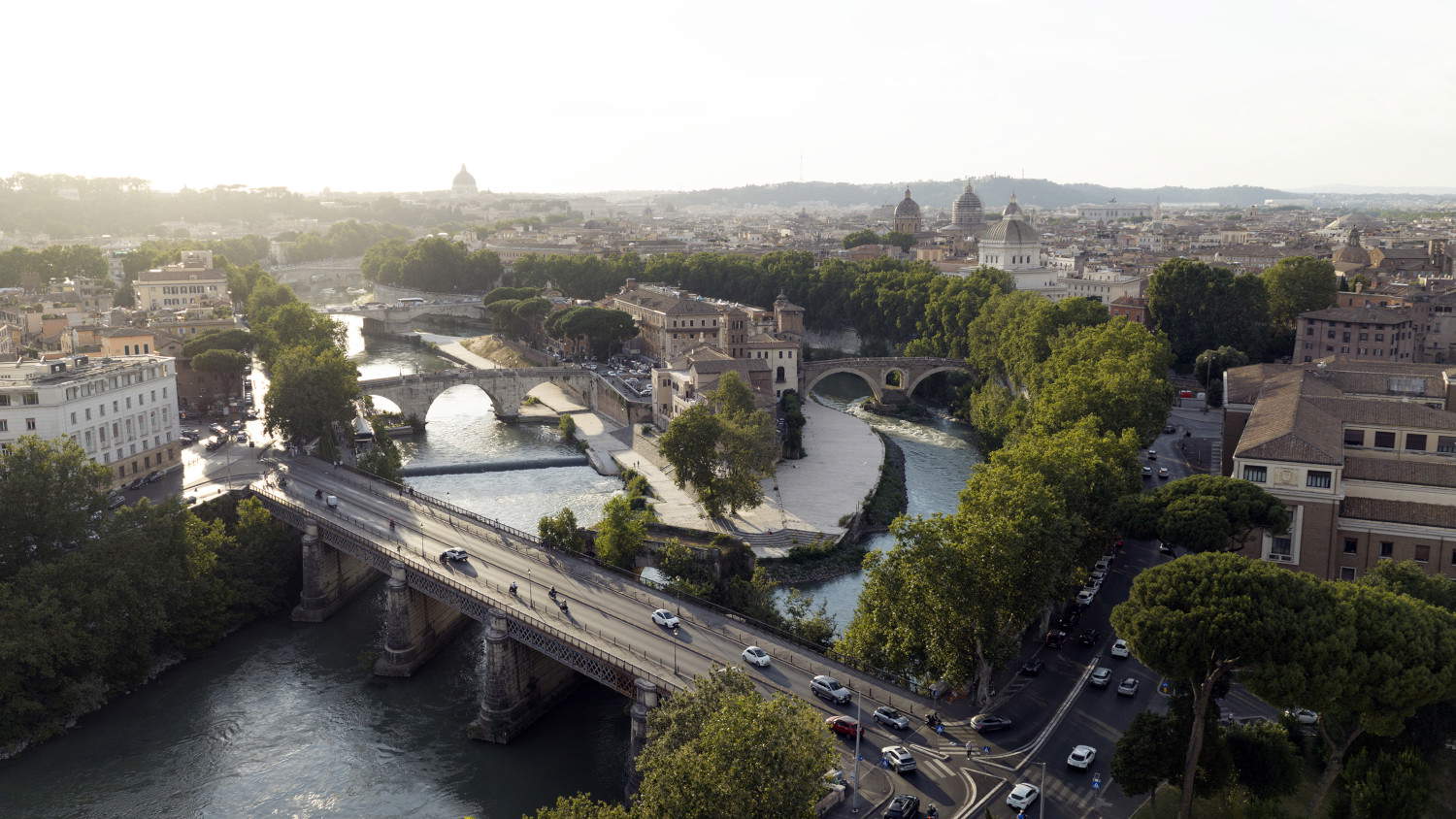
The project covered a stretch of approximately twelve kilometers of the river, from Ponte Flaminio to Valco San Paolo, thus encompassing the entire section of the Tiber that flows through the urban center of Rome.
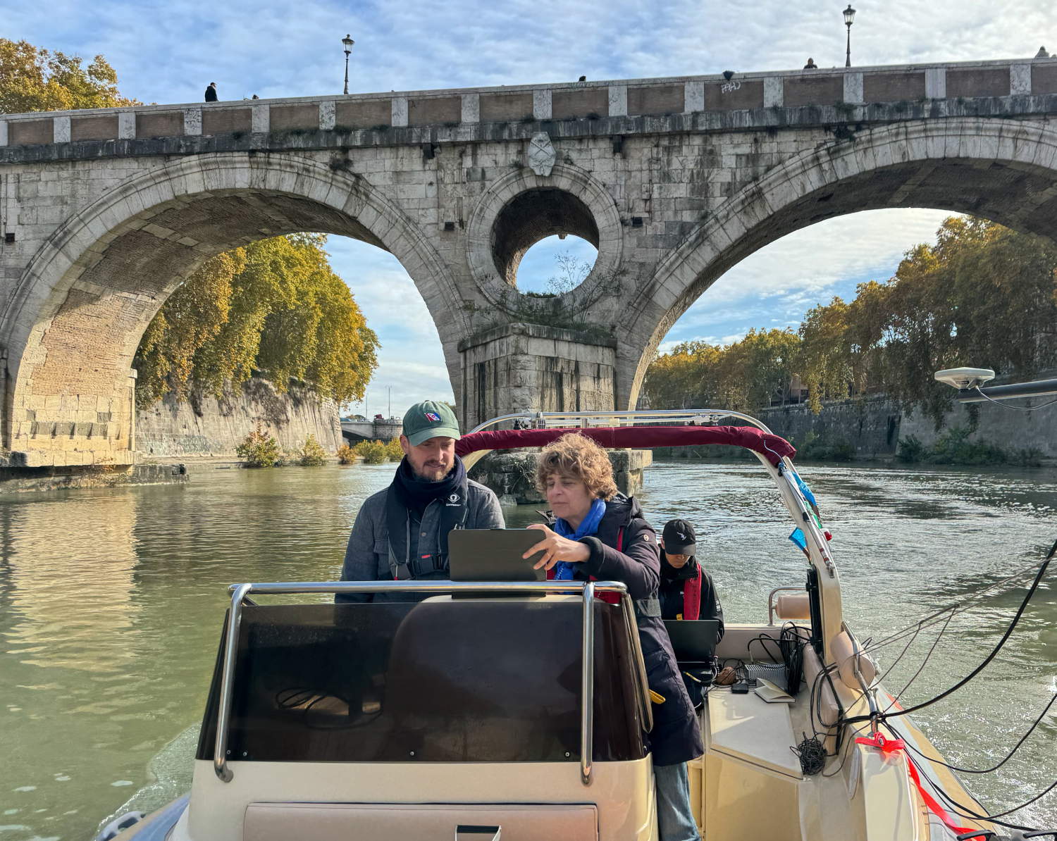
To create a detailed map of the waterway, sophisticated geophysical technologies were used, capable of producing a three-dimensional reconstruction of both the riverbed and the surrounding landscape. A NORBIT Winghead multibeam system used sonar to acquire three-dimensional data on the riverbed, while a LiDAR scanner employed laser technology to survey the surrounding environment. The real-time combination of these two types of data allows for the reconstruction of a sort of image of the city extending from the mainland to the riverbed, making it possible to trace the continuity of archaeological structures between the two areas.
To complete the survey, a sub-bottom profiler was deployed—an instrument capable of sending acoustic signals into the sediment and identifying various stratigraphic sequences down to a depth of approximately 15 meters. The anomalies revealed by the geophysical surveys were subsequently verified through underwater operations conducted by the Rome Carabinieri Underwater Unit, which also provided photographic documentation of the remains.
The presence of archaeological finds in the Tiber has been known for centuries. Ancient sources and discoveries made during numerous construction projects have yielded architectural elements, marble columns, and works of art—including statues—from the river. The course of the Tiber has also been the subject of numerous cartographic representations and scientific surveys over time, ranging from the hydrological maps created in the 18th century by engineers Andrea Chiesa and Bernardo Gambarini to the more recent hydrological and geological studies by the Tiber River Basin Authority and the National Research Council. The first systematic underwater archaeological surveys in this section of the river date back to the 1980s and were conducted by Claudio Mocchegiani Carpano, first an archaeologist with the Archaeological Superintendence of Rome and later director of the Technical Service for Underwater Archaeology at the Ministry of Cultural Heritage and Activities.
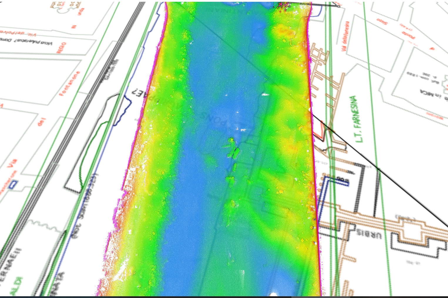
However, the current project represents a significant leap forward: for the first time, a geophysical map has been created that is designed as a true archaeological and conservation plan. This new cartography allows scholars not only to locate submerged structures but also to understand their context, assess their state of preservation, and develop strategies for the long-term protection of Rome’s submerged archaeological heritage.
The surveys have identified hundreds of traces of human activity, including architectural structures of considerable size and shipwrecks. Among the most significant findings are new data regarding the numerous bridges that spanned the Tiber throughout various historical periods. Geophysical technology has made it possible to gather detailed information on the morphology and structure of the remains. Of particular significance is the identification of structures attributable to the Pons Neronianus—the so-called Bridge of Nero—which was located near the present-day Vittorio Emanuele II Bridge. The bridge’s eastern pier, which was already partially visible, has recently become more clearly visible thanks to the low water levels of the Tiber. The other piers, however, are identifiable through data obtained from geophysical surveys.
Another discovery of great interest concerns the area of the Villa Farnesina, where investigations have revealed a complex submerged landscape consisting of buildings and various structures. Some portions of the villas that once stood in this area had already been recovered during the construction of the retaining walls along the Lungotevere. Today, these artifacts are preserved and on display at the National Roman Museum in Palazzo Massimo.
The new geophysical data now allow us to expand our understanding of this context, also documenting the extent of the structures that remain submerged and are still located in the Tiber riverbed.
The research on the Tiber is part of a broader international collaboration aimed at understanding and preserving underwater cultural heritage. This context also includes director Martin Scorsese’s visit to the Central Institute for Restoration, which took place as part of the production of the documentary *Shipwrecks of Sicily*, directed by Peter Campbell and produced by Lisa Briggs. During the meeting, Scorsese recorded a conversation with Barbara Davidde focused specifically on the conservation of submerged cultural heritage.
Surveys conducted to date show that the Tiber still harbors an extremely vast archaeological heritage, much of which remains to be explored. For this reason, the project includes new research campaigns, including dives focused on the shipwrecks and sites identified during the surveys. Another objective will be to develop a management plan for the long-term protection and conservation of Rome’s submerged cultural heritage.
This issue takes on even greater importance in 2026, the year marking the 25th anniversary of the 2001 UNESCO Convention on the Protection of the Underwater Cultural Heritage. Italy played a particularly important role in the drafting and implementation of the Convention, which is one of the fundamental international instruments for the protection of underwater cultural heritage.
The mapping of the Tiber River therefore represents not only an important scientific endeavor but also a decisive step toward greater awareness of the capital’s submerged archaeological heritage.
“I find it particularly significant that the celebration of the 25th anniversary of the 2001 UNESCO Convention on the Protection of the Underwater Cultural Heritage coincides with the presentation of the first results of this project to survey and document the extent and state of preservation of the monumental, archaeological, and historical-artistic heritage of the Tiber,” stated Luigi Oliva, director of the Central Institute for Restoration (ICR). “This takes on even greater significance for the ICR, given that we are preparing to celebrate the 25th anniversary of the ICR’s ‘Restaurare sott’acqua’ project, which forms the ethical and methodological foundation of this approach to submerged cultural heritage.”
“Strengthening the bond between the city and its river is one of the cornerstones of the urban regeneration projects overseen by the Special Superintendence of Rome, which is being realized through two major initiatives focusing on the left bank of the Tiber. This is a gradual process of returning the neglected and abandoned spaces along the riverbanks to the city; these areas will become accessible spaces that are seamlessly integrated into Rome’s urban and cultural landscape, based on interaction and cooperation among various agencies and local entities. “This synergy is also evident in the research conducted on the Tiber’s underwater heritage,” stated Rome’s Special Superintendent, Daniela Porro.
“Every monument and every stone in Rome has been studied; even the Tiber—the lifeblood of the ancient city and the very reason for its existence—has in the past been the subject of historical and topographical research, the recovery of works of art, and direct investigations conducted with the means available at the time. Much, however, remains unexplored from an archaeological perspective. This multidisciplinary geophysical survey, which employs state-of-the-art equipment, constitutes the first step in a long-term study of the river’s submerged archaeological heritage,” emphasized Peter Campbell.
“Documenting and assessing the state of preservation of the artifacts is a prerequisite for any archaeological intervention,” explained Barbara Davidde. “The survey does not merely reveal the position and shape of structures or individual artifacts; it allows us to assess their physical condition and identify the sedimentary and environmental dynamics that govern their deterioration. This work requires collaboration across different fields—archaeology, conservation, and ecology—because in the Tiber, the archaeological artifact and the river ecosystem form a single entity, and the in situ conservation of the former cannot be separated from the latter. Our project also pursues a further, no less significant goal: to restore to Romans an awareness of a submerged heritage that lies in the river flowing before their very eyes, but which for many of them remains invisible and still largely unknown.”
“The Tiber remains Rome’s iconic landscape feature to this day,” added Alessandra Fassio. “A restless and intriguing river, hidden yet longed for by the city. This is why the Special Superintendency has undertaken an integrated project for the river called TEVEREVER, where past and future converge in the river’s renewed integration into urban life. Conservation and research through underwater archaeology become indispensable tools for fully understanding the city’s extraordinary stratigraphy, which has been deposited in the riverbed. This comprehensive understanding is directed toward highlighting the findings of these studies and is integrated into new services for the city that restore the riverbanks to Rome’s urban life.”
|
| Underwater Archaeology in Rome: Hundreds of Submerged Archaeological Artifacts Discovered in the Tiber River |

Warning: the translation into English of the original Italian article was created using automatic tools. We undertake to review all articles, but we do not guarantee the total absence of inaccuracies in the translation due to the program. You can find the original by clicking on the ITA button. If you find any mistake,please contact us.

























 IT
IT FR
FR DE
DE ES
ES CN
CN