

A digital mapping campaign of the shoal of Capo Graziano, one of the most relevant underwater archaeological contexts in the Mediterranean, has begun in Filicudi, in the Aeolian Islands. The project, developed by the Sicilian Region’s Superintendence of the Sea in collaboration with technology startup Immersea, aims to return a three-dimensional model of the seabed and wrecks in the area. The initiative is part of a long-term strategy that combines scientific research, technological innovation and the protection of the underwater cultural heritage, in a perspective defined by the promoters themselves as archaeological oceanography.
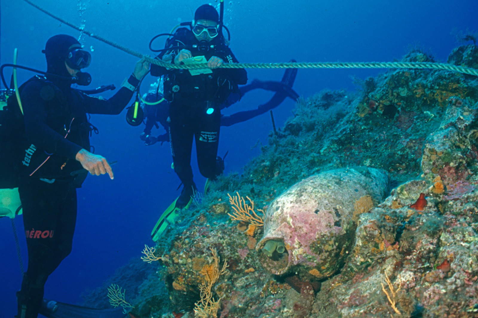
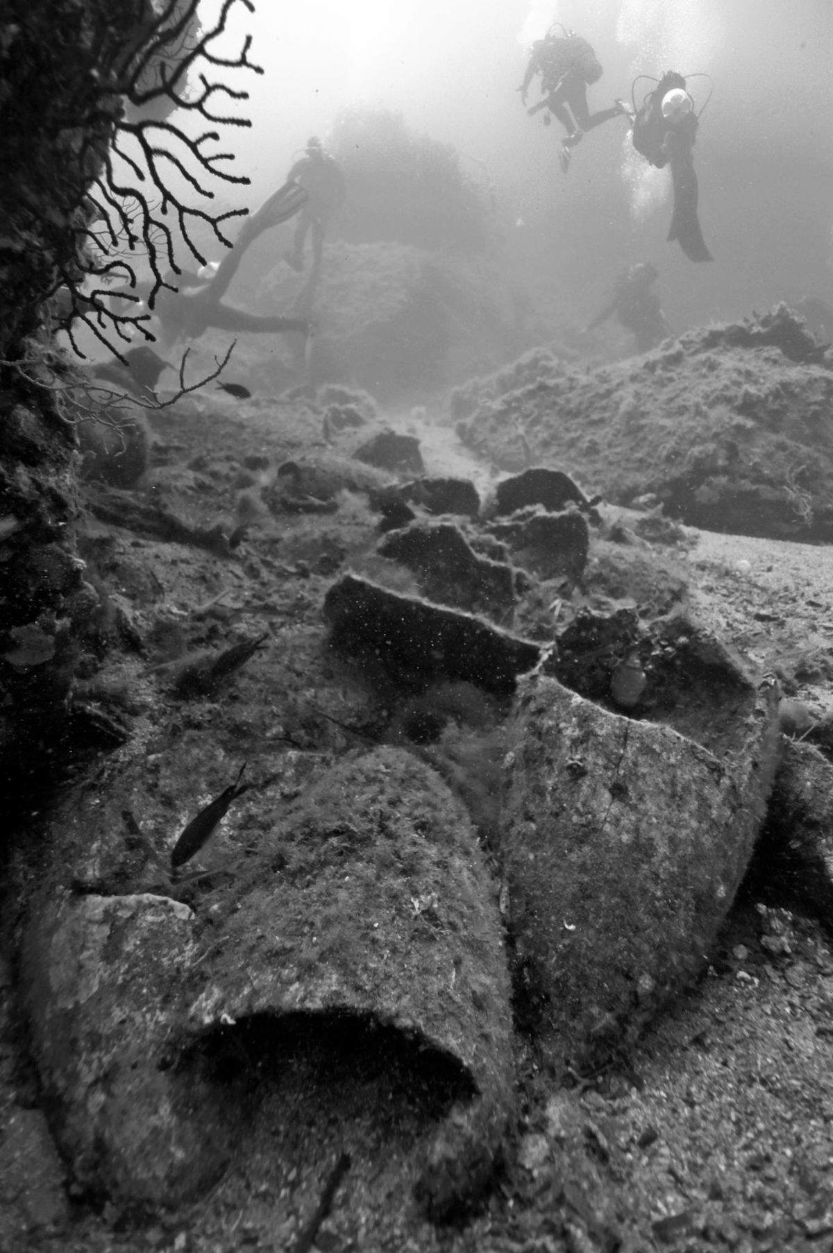
The area has long been the focus of attention of the Superintendence of the Sea, which in recent years has developed an underwater cultural itinerary around the shoal, accessible to licensed divers accompanied by authorized diving centers. The route winds along a seabed that varies between 5 and 30 meters deep, where artifacts from different eras can be seen: amphorae, lead and lithic anchors, but also the fragment of a hydrofoil wing that sank in recent times, testifying to the dangerousness of the area for navigation in any era.
“This activity represents the first piece of a multi-year project,” said Councillor for Cultural Heritage and Sicilian Identity Francesco Paolo Scarpinato, “which aims to make the Capo Graziano shoal a pilot laboratory of preventive conservation and intelligent use of the underwater heritage. A place where science meets history and technology opens new horizons to knowledge and protection. This will make it possible to anticipate degradation scenarios, optimize monitoring strategies, and support targeted protection and intervention decisions. This is a pioneering approach in Europe, setting new operational standards for the intelligent management of underwater archaeological heritage.”
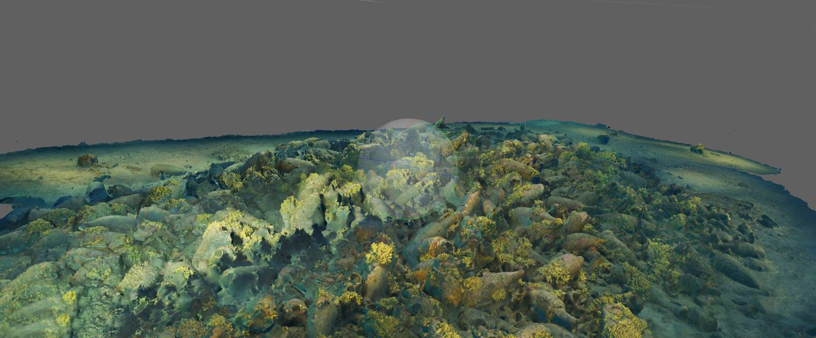
Traditional use will now be joined by digital use, thanks to an ultra-detailed survey carried out using underwater photogrammetry and advanced integrated positioning techniques. 360-degree, ultra-high-resolution 3D stereoscopic cameras will be used to create the digital model, supported by underwater navigation systems using the dead reckoning or estimated navigation method. The system makes it possible to determine the position of surveying assets based on the course followed and speed, integrating the information with environmental modules equipped with multi-parameter probes and geochemical sensors.
The output will be a georeferenced three-dimensional model that, in addition to serving as a documentation and dissemination tool, will represent a true permanent scientific infrastructure that can be updated over time. Within it, wrecks already known and those that may be discovered in the future will gradually be located and digitized. Each item will be accompanied by digital fact sheets that will include archaeological, geomorphological and environmental data. The system will also allow the environmental and physicochemical conditions of the finds to be monitored over time, providing useful data for creating predictive models on the risk and preservation of submerged materials.
The Capo Graziano marine area has been known to the scientific community since the 1970s, when pioneering investigations conducted by Luigi Bernabò Brea and Nino Lamboglia uncovered a significant concentration of ancient wrecks in a limited but strategic area for Mediterranean shipping routes. Among the best known is the so-called Roghi Wreck, known for its “pyramid of amphorae,” now on display at the Aeolian Regional Archaeological Museum. The shoal, in fact, presents itself as a navigational hazard and has been a critical point for vessels of various kinds over the centuries. This has led, over time, to the overlapping of wrecks belonging to different eras, making their identification and study complex.
Today, more than fifty years after the first explorations, the site is again being subjected to scientific investigations, but with the support of technological tools capable of returning with greater precision the conformation of the seabed and the archaeological context. The data collected will be able to contribute in a way to understanding the historical, economic and environmental dynamics that have affected the area over the centuries, but also offer new tools for the sustainable management and enhancement of the underwater heritage.
In addition, Scarpinato, called the project “a meeting between science and history,” emphasizing how the operation combines technological expertise and cultural purposes in an area, that of the valorization of the submerged heritage, which the Sicilian Region intends to strengthen. The mapping campaign launched at Cape Graziano is destined to become a replicable case study in other underwater archaeological contexts in the Mediterranean, where environmental conditions and access difficulties still make research, documentation and conservation work complex.
 |
| Capo Graziano, digital mapping arrives for Filicudi's archaeological seabed |

Warning: the translation into English of the original Italian article was created using automatic tools. We undertake to review all articles, but we do not guarantee the total absence of inaccuracies in the translation due to the program. You can find the original by clicking on the ITA button. If you find any mistake,please contact us.


