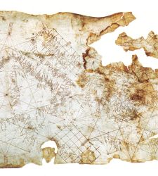
In the panorama of medieval cartography, the birth of the firstportulan chart of the Mediterranean marked a momentous turning point in the way geographic space was conceived and represented, and between the 13th and 14th centuries, a new tool made i...
Read more...


