Nestled between the Alps, the Stura di Demonte Valley stretches in Piedmont, in the province of Cuneo, for more than sixty kilometers along an axis that joins Italy to France: starting from Cuneo it leads to the Colle della Maddalena, an important pass that connects the Stura Valley to the Ubaye Valley in Haute Provence. The valley owes its name to the Stura di Demonte River, the main left tributary of the Tanaro. The territory includes twelve municipalities, each with its own history and places of interest, for a valley full of treasures to discover, including culture, art, nature and traditional flavors.
It is one of the alpine valleys of the Cuneo area that offers a vast cultural heritage, which, thanks to the contribution of the CRC Foundation, as part of the Cultural Heritage call, with the project “Valle Stura: una valla, mille opportunità,” it has been possible to map entirely. In this article we see which are the most interesting sites in the Stura Valley, for an interesting travel itinerary.
Since Roman times a strategic center for trade with Gaul, Borgo was founded between 14 B.C. and 14 A.D., but only in 1167 did it become Burgus Sancti Dalmacii, referring to the patron saint Dalmazzo, evangelizer of the Stura Valley and martyred in 254 A.D. Today it is an artisan and industrial center, in a privileged position of passage to the Ligurian Riviera and the French Riviera. Among its monuments of interest is the Civic Tower: built in the Middle Ages in stone and brick, it was the ancient “gate-tower” that served as a defense for the castle and the ricetto; damaged in the mid-16th century by the French, it was restored by Emanuele Filiberto of Savoy between 1573 and 1581. The clock, on the other hand, dates from 1837: the bells rang to warn citizens of dangers, and today, in addition to chiming the hours, they also inform of the convening of the town council. A plaque above the front door commemorates the ten citizens who fell in the wars of independence between 1848 and 1855. A canopy on the side, called a pelerin, welcomes travelers and pilgrims when stopping along the way.
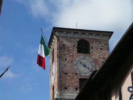 |
| The Civic Tower of Borgo San Dalmazzo |
Gaiola is the smallest village in the Valley. Its name seems to indicate a Gallic colony, but more certainly alludes to the nature of the soil, indicating a densely wooded place. Its economy is based mainly on agriculture, particularly vegetables and small fruits, in forage, chestnut harvesting and undergrowth products. It offers many nature-environmental attractions and it is possible to practice canoeing and rafting. Along the old mule track to Rittana is the Chapel of St. Bernard, a rare testimony of the 16th century in the valley. Inside is still partly visible a fresco that depicts, in an architectural structure with grotesque decoration, Jesus deposed from the cross in the arms of the Madonna with St. Mary Magdalene and St. John; at the sides are St. Bernard of Menton, to whom the church is dedicated, and a holy bishop, perhaps St. Grato.
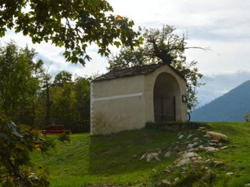 |
| Gaiola - Chapel of St. Bernard |
Moiola, whose name is said to refer to the Latin molliola, meaning a wet area prone to flooding, saw the deaths of many young men during the two world wars, although an impressive defensive system was built.
Ruins of the 14th-century castle remain to the right of the valley and the chapel of St. Anne. It is possible to drive along the military road, probably built in the 18th century, where according to tradition the Roman road passed; it runs on the hydrographic right of the Stura, almost parallel to the state highway. It turns out to be rather narrow, but it is shady and pleasant to walk along.
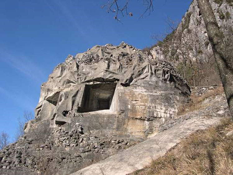 |
| Fortifications of Moiola |
The capital of the valley, Demonte is the 14th largest municipality in Piedmont. Its territory is dominated by chestnut, beech and wide pastures; the economy is based on sheep and cattle breeding, lavender harvesting and officinal herbs for the preparation of liqueurs and oils. Today it is also a winter tourist hub with its cross-country ski trails.
Worth visiting is the Borelli Park built between 1828 and 1860 by Count Giacinto Borelli, appointed by King Victor Emmanuel I with the post of regent of the Royal Chancery of Sardinia, and later First President of the Senate of Genoa (1831) and Minister for Internal Affairs (1847) by the King of Sardinia Charles Albert VII. It is to the count that we owe the preparation and signing of the Statuto Albertino in 1848. The park was built where an ancient castle stood, built by Charles of Anjou in 1305: he provided it with fountains and shady corners, a greenhouse, and paths leading to the top, where the Angevin castle stood, of which only a wall remains today. Inside the park is the Chapel of St. Bernard, a castle chapel until 1300 and then used as a cemetery; in 1844 it was granted by the municipality to Count Borelli, who made it the family’s funeral chapel. Also interesting evidence of the life of the Lords of pre-modern Demonte is the Icehouse, where ice was stored in the past.
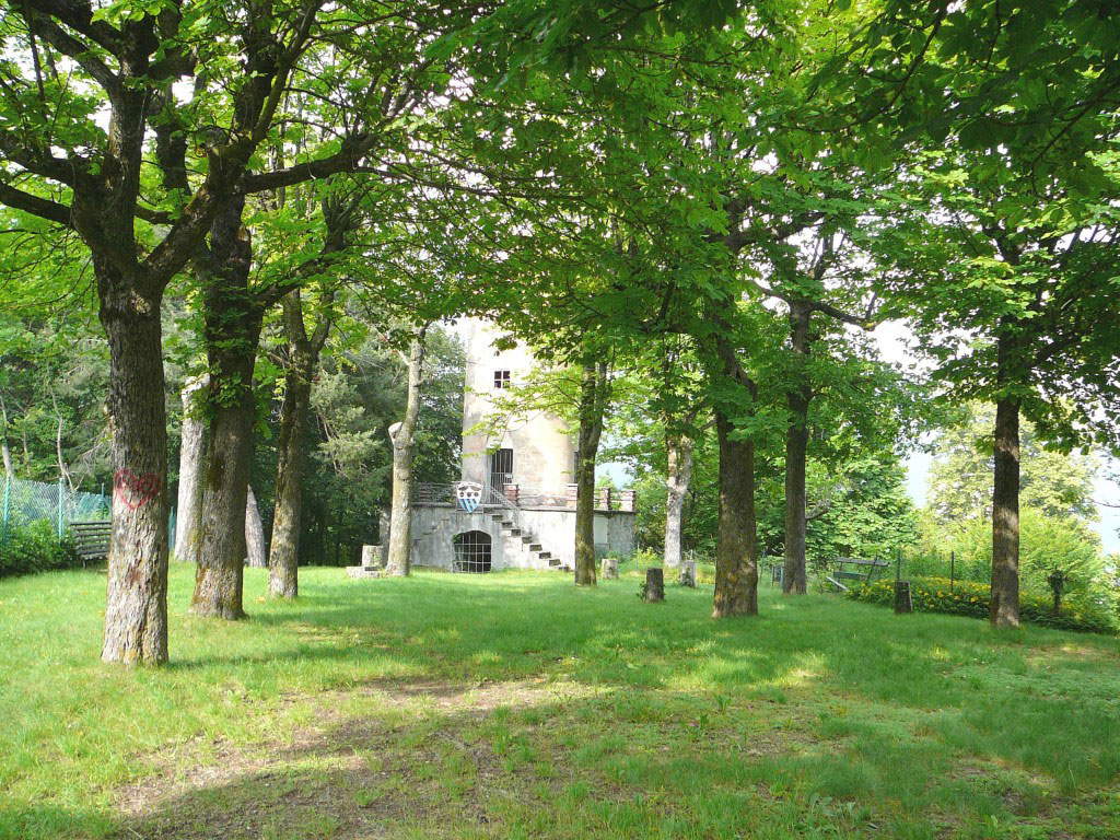 |
| Demonte, Borelli Park |
On a moraine ruin at the foot of imposing limestone rocks stands Aisone, among the oldest villages in the Valley: it seems that the first settlements in the Stura Valley took place here. Its name is said to derive from izour or izoun, or pool of water in which hemp was macerated, the cultivation and processing of which was practiced here until the 20th century. Aisone is part of the Maritime Alps Natural Park. At Morra, a rare aqueduct with stone arches of medieval origin can be seen, which probably served a mill or was used for hemp processing activities.
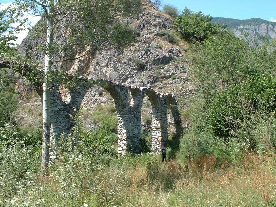 |
| Aqueduct of Aisone |
Vinadio is the second largest municipality in Piedmont after Alexandria, at 183 kilometers (183 miles). The development of tourism has been favored by the presence of cross-country ski trails and the presence of Forte Albertino and the thermal baths, which have been joined in recent years by the mineral water indutria.
The Albertine Fort is considered among one of the most significant examples of military architecture in the entire Alpine region. Commissioned by King Charles Albert, a large part of the town was demolished for its construction beginning in 1833: work began in 1834 and was completed in 1847. Despite an interruption from 1837 to 1839, in only eleven years a true work of engineering and military technique was realized. Approximately ten kilometers long, the Fort, which runs on three levels of walkways, is divided into three fronts: Upper Front, Attack Front, and Lower Front. A small chapel still stands inside. The large barracks adjacent to the National Street was added in 1884.
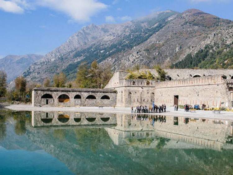 |
| Fort Albertine of Vinadio |
Dominated by Mount Bersaio, Sambuco owes its name, according to some, to the presence of the shrub of the same name, but it is more likely to refer to Occitan with reference to the dangerous valley passage. In ancient times hemp and flax were cultivated, but between the 17th and 19th centuries the production of lime in kilns was much practiced. Today the economy is based on agriculture, Sambucan cattle and sheep breeding, forest exploitation, and summer and winter tourism. The San Bartolomeo Bell Tower can be seen on Provincial Road 144: it dates back to medieval times, to the 14th century, and is the bell tower of the first parish of Sambuco, which was housed in the church of San Bartolomeo, demolished in the 19th century.
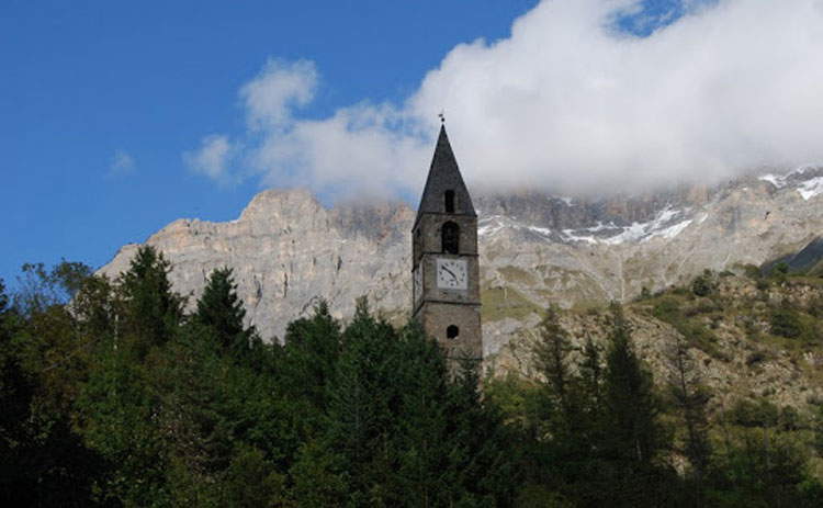 |
| Bell Tower of San Bartolomeo |
Pietraporzio, on the banks of the Stura River, owes its name to a large boulder that, according to one legend, offered shelter during the night to the proconsul Porzio Romano: linked to this story is the presence of the “stone houses” in Saretto, which stand perhaps on the ancient fortified site of the village. Another interpretation refers the name back to petra porci, which later became in Occitan Peiropùorc, pig stone, referring to the shape of the large rocky promontory.
At the Pietraporzio cemetery is the four-story tower also known as the “quatre loups bell tower,” because of its four apotropaic sculptures in the shape of wolf heads. It is the only remnant of the ancient church of St. Stephen. The four sculptures do not serve as gargoyles: this enhances their symbolic and mysterious potential, making the wolf, a symbolic animal of the alpine territory, a kind of guardian or sentinel. The bell tower dates back to 1466.
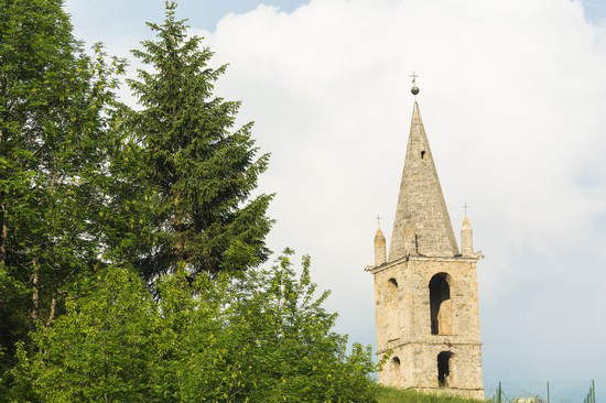 |
| The bell tower of the four wolves of Pietraporzio. |
Located on the border with France, Argentera owes its name to the presence in ancient times of mines from which argentiferous lead was extracted. Its vast territory is occupied by forests, pastures and relief and is a destination for many groups who frequent the alpine houses characteristic of the area. Argentera’s municipal seat is now located in Bersezio, the most populous hamlet in the municipality.
The very hamlet of Bersezio is home to the church of San Lorenzo dating back to 1018. The priory of St. Lawrence of Bersezio was founded around the year 1000 by the monks of St. Theophredus of Le Puy, who built many churches in the area. The interior of the church has a single nave and no fresco decoration on the walls or vault, but several wooden altars with 17th-century canvases.
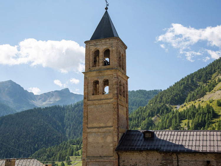 |
| The church of San Lorenzo di Argentera |
Borgata Paraloup, in the municipality of Rittana, is located at an altitude of about 1,400 meters on the ridge separating the Stura Valley from the Grana Valley. According to tradition, its name means “defense from wolves.” In this place, between 1943 and 1944, the first partisan band of Giustizia e Libertà, commanded by Duccio Galimberti, Dante Livio Bianco and Nuto Revelli, gathered. For some years now, thanks to the
Nuto Revelli Foundation, Paraloup has once again become a place of memory that tells of the partisan war and peasant life.
After participating in World War I, Rittana was a protagonist in the war of liberation. Today, in fact, tourism related to the Resistance has developed.
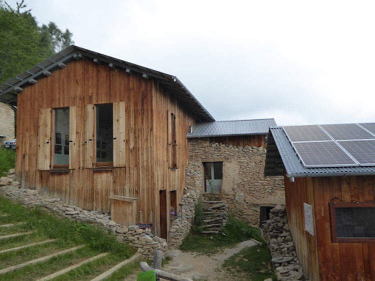 |
| Rittana, Borgata Paraloup |
As the name suggests, Roccasparvera was a fortified place reminiscent of a nest of sparrowhawks, perched high above the Stura. In 1319 Queen Joan of Anjou enfeoffed the village to the Bolleris, lords of Centallo and Reillane, and in 1356 Franceschino Bolleris became lord of Roccasparvera. Protected by the French court, the Bolleris opposed the Savoy for more than a century: their rule ended in about 1559, when the castle, defended by a thousand French soldiers, was destroyed by the Cuneesi and the village thus passed to the Savoy.
To the Bolleris is dedicated the imposing gate that today bears witness to the majesty of the walls that anciently surrounded the village. Goods and men from and to France passed through the Bolleris Gate.
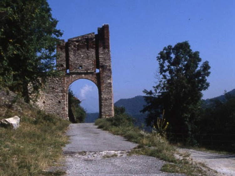 |
| Roccasparvera, Bolleris Gate. |
The existence in Valloriate of the Benedictine priory of San Michele is documented around the 11th century: the village probably developed initially opposite the latter, on the Serre ridge. Formed by forty-two hamlets, it was in the 16th century that many high-altitude hamlets were born: they are arranged on the orographic left, on the right, and in the upper part of the valley floor. Symbols of Valloriate, both present on the coat of arms, are the towers, which refer to its belonging to the Marquisate of Saluzzo, and the chestnut trees, the main resource of the village.
As early as 1386 the presence of the church of San Michele is attested for the first time in a document, in the Registrum del Cattedratico. It stands on a spur in a bend of the stream, and the transformation of the primitive building that still retains Romanesque-Gothic parts dates back to 1680. During restorations in 2010, 18th-century frescoes were found in the apse part of the church: the center depicts a God the Father and a baby Jesus in the guise of Salvator Mundi, who are surrounded by angels in flight.
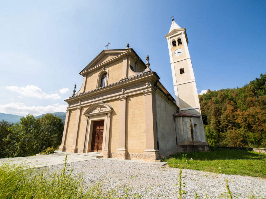 |
| The church of St. Michael of Valloriate |
Located at the bottom of the valley near the course of the Stura, Vignolo, as the name itself recalls, is linked to the production of grapes and walnut oil. It has very ancient origins: consider that in the Middle Ages it played an important role because it was on the Salt Road. Worth seeing is the Chapel of San Rocco, built by the 125 inhabitants who survived the plague of 1630. In the 19th century it was expanded by making radical transformations: the orientation was changed, the portico was added, and the facade was frescoed with the image of the saint to whom the chapel is dedicated.
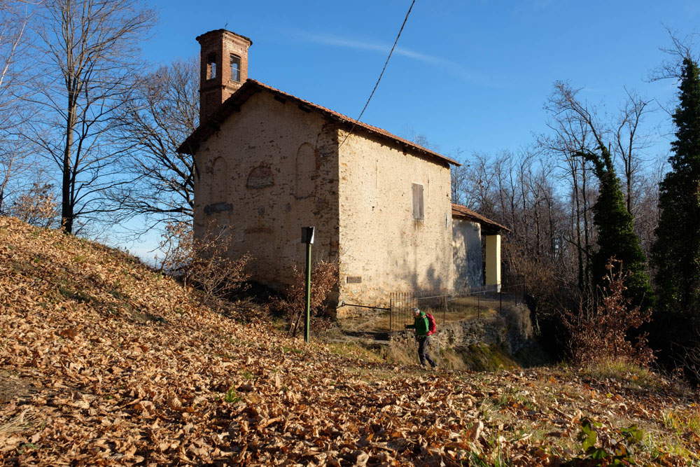 |
| The chapel of San Rocco in Vignolo |
 |
| Piedmont: 13 places to see in Stura Valley, including culture, art and nature |
Warning: the translation into English of the original Italian article was created using automatic tools. We undertake to review all articles, but we do not guarantee the total absence of inaccuracies in the translation due to the program. You can find the original by clicking on the ITA button. If you find any mistake,please contact us.