

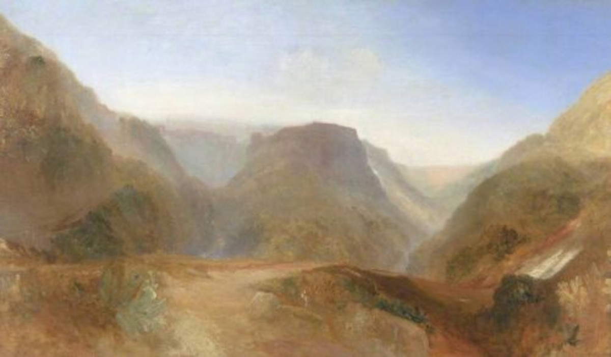
An investigation signed by Mauro Bernabei of CNR-Ibe and Stefano Celletti, director of Marturanum Park, has revealed striking similarities between the landscape depicted by William Turner in the unfinished Italian Landscape and the stretch of the Biedano stream near the Devil’s Bridge in Blera, in the province of Viterbo. Published in the Journal of Cultural Heritage, it adds a new piece to the geography of Italian places that inspired the great painter of English Romanticism.
Indeed, the study proposes a new location for the painting Italian Landscape, probably Civita di Bagnoregio (1828), now housed at the Tate Britain in London. Comparative analysis between the work and the actual landscape revealed remarkable morphological correspondences with the area of the Biedano stream in Blera, contrary to earlier assumptions in previous attributions to Civita di Bagnoregio or Pitigliano. “The place painted by William Turner had been identified as Civita di Bagnoregio (or perhaps Pitigliano), although doubtfully,” Bernabei explains.
Considered one of the greatest landscape painters of Romanticism, Joseph Mallord William Turner (1775-1851) is famous as the “painter of light” for his innovative use of color and atmospheres poised between reality and dreams. Turner traveled to Italy several times in search of new chromatic and luministic inspirations. It was precisely in 1828, the year in which he made the painting, that the artist visited Tuscia, and numerous sketches in his notebooks depict views of Viterbo, Nepi, Ronciglione, Montefiascone and Caprarola, localities not far from Blera. The Devil’s Bridge, probably from Roman times located along the ancient Via Clodia, was also an important stop on the Grand Tour to Rome through Tuscia at the time.
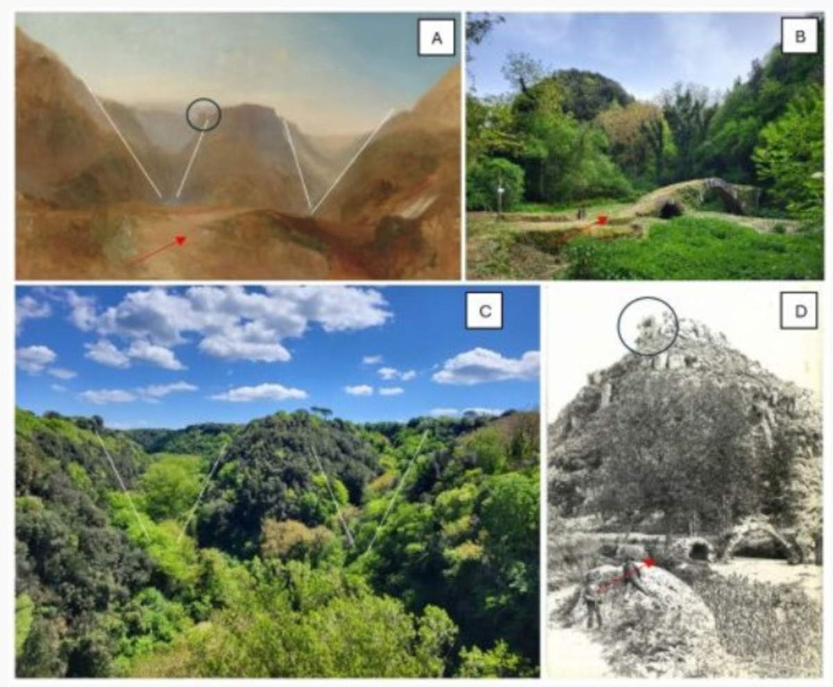
“The similarities between the pictorial composition and the real landscape are numerous and detailed: from the ’W’ shape of the valleys, to the position of the bridge and the path, to the perspective adopted by Turner,” Mauro Bernabei explains. “Thanks to historical sources, we were able to reconstruct the environment as it was in the early 19th century, confirming the plausibility of our hypothesis. Initially, Turner’s 1828 trip to Italy was virtually retraced; then, a multilayered approach combining geomorphological observation, analysis of historical images, and matching topographical references was used. The shape and arrangement of the hills depicted in the painting were examined through a comparative geomorphological assessment, which focused on morphological profiles and relative spatial orientation. Historic photographs and early cartographic sources were used to trace changes in vegetation cover and settlement patterns over time; this analysis allowed reconstruction of the visual environment as it may have appeared in the early 19th century. Key structural elements within the composition, such as the path, bridge, and their respective positions relative to natural features, were identified and used as fixed points for matching with real-world locations. Digital overlays were then applied for more precise spatial correlation.”
“This discovery further enhances the historical and natural heritage of Tuscia,” adds Stefano Celletti, Marturanum Park director. “It is an extraordinary opportunity to promote the area through art and history and to strengthen the link between landscape and cultural identity.”
|
| New survey identifies William Turner's Italian Landscape with the Devil's Bridge in Blera |

Warning: the translation into English of the original Italian article was created using automatic tools. We undertake to review all articles, but we do not guarantee the total absence of inaccuracies in the translation due to the program. You can find the original by clicking on the ITA button. If you find any mistake,please contact us.


